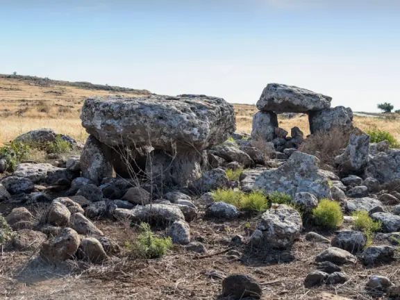
A Post-Collapse Deed of Ownership
Why would a decentralised, highland tribal society suddenly begin building megaliths in the immediate aftermath of a global systems collapse? The answer lies in the ultimate evolution of the "Architecture of Anxiety."
In the Maghreb, the anxiety was ecological. In the Levant, it was a political reaction against expanding urban city-states. In Thrace, the anxiety was driven by the demographic terror of the 1200 BCE collapse (Middleton, 2010; Cline, 2014).
The fall of the Mycenaean palaces unleashed migrating tribes and raiders across the Balkan Peninsula. The world was frighteningly volatile. Ancestral grazing lands were suddenly under threat from desperate, displaced populations moving south. The Thracian tribal aristocracy needed a way to anchor their legitimacy in a landscape that was rapidly destabilising. They turned to the oldest, most visceral language of power available, immovable stone.
By erecting massive dolmens on the prominent ridges and mountain flanks of the Sakar and Strandzha massifs, the Thracians were casting an anchor into the storm. A heavily engineered megalithic tomb, housing the remains of a deified chieftain or "hero," was the ultimate territorial marker. It was a post-collapse deed of ownership, projecting a clear, indestructible message to any migrating tribes passing through the valleys below, ‘This land belongs to our ancestors, and we are not moving.’
While the Levantine dolmens of the Early Bronze Age were often born of economic strangulation and marginalisation, the Thracian dolmens of the Early Iron Age (c. 1200–600 BCE) tell a different story. They are the stone deeds of a warrior elite asserting absolute dominance over a destabilised frontier.
Let us look at four of the most revealing dolmens built during this period.
Nachovi Chairi (Hlyabovo, Sakar Mountains): The Twin Megaliths
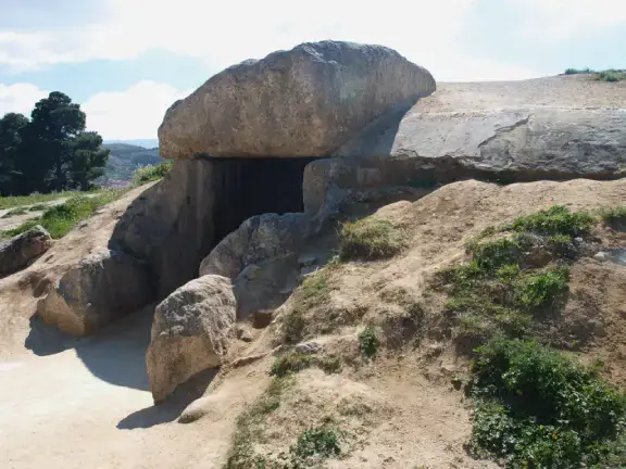
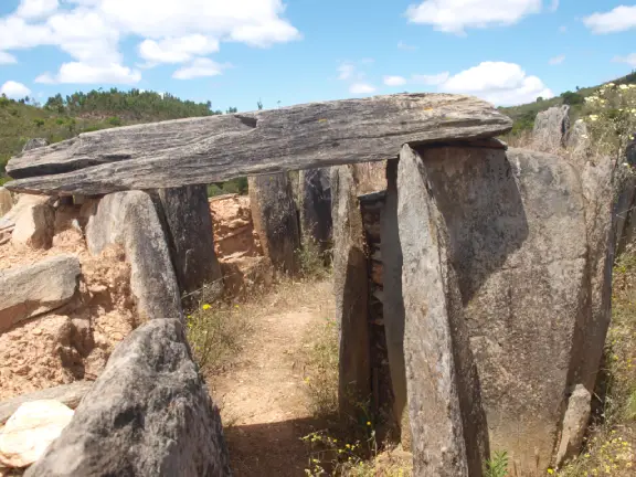
Located near the village of Hlyabovo in the Sakar Mountains of south-eastern Bulgaria, Nachovi Chairi is arguably the most famous and architecturally complex dolmen site in the Balkans. Unlike many Sakar dolmens that crown exposed mountain crests, Nachovi Chairi sits tucked away within a sheltered ravine, though when discovered in the 1970s it was sealed beneath an imposing 10-metre earthen tumulus, an unmistakable territorial anchor along the approach (Delev, 1984; Nekhrizov, 2015).
It is a remarkable "twin" monument: two attached two-chambered dolmens (four chambers in total) sharing a single monumental façade. Its massive covering capstones, measuring over 2.5 metres in length and weighing an estimated 15 to 20 tonnes, remain ‘in situ’.
Like the vast majority of Sakar dolmens, the entrances of Nachovi Chairi are strictly oriented toward the south/south-east (González-García et al., 2008). Archaeoastronomers have linked these southern orientations to solar cults, marking the sun's arc and the winter solstice rebirth of the deified chieftain, while wider regional surveys suggest that many Sakar dolmens were simultaneously aligned toward distant sacred mountain peaks on the horizon, such as the Gorata Ridge in the Eastern Rhodopes (Fol and Fol, 2005; Kolev et al., 2008).
Excavations at Nachovi Chairi yielded intact human remains within one of the chambers, a landmark breakthrough in Bulgarian dolmen archaeology, alongside a rich Early Iron Age assemblage including dark-burnished pottery with geometric decoration, amber beads, and bronze fibulae (clothing clasps).
Its primary construction and burial phase dates to the 9th and 8th centuries BCE (continuing into the 7th century BCE), though the site remained a venerated cult location for centuries afterwards (Nekhrizov, 2015).
The Roussa Dolmen (Evros, Greek Thrace): The Southern Frontier Marker
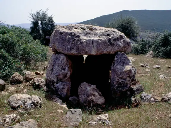
Situated in the Eastern Rhodopes, in the modern Greek regional unit of Evros, the Roussa dolmen forms part of the absolute southernmost frontier cluster of the entire Thracian megalithic phenomenon, a border zone where over a hundred megalithic graves have been recorded, densest around Kotronia and Koila, with scattered outliers reaching as far as Samothrace (Triandaphyllos, 1983). Sitting on a rocky, desolate slope looking south towards the Aegean transit corridors, Roussa acts as a physical border post on the fault line between the destabilised Aegean world and the tribal Thracian interior, a clear territorial warning to migrating groups moving through the Rhodope passes (Triandaphyllos, 1983; Nekhrizov, 2015).
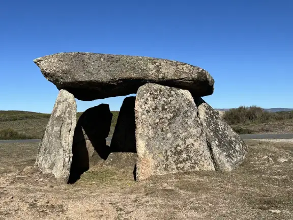
While slightly smaller than the Sakar giants, it is impeccably engineered. It features a main burial chamber and a smaller antechamber, constructed from heavily weathered gneiss slabs weighing between 5 and 8 tonnes.
Unlike the south-eastern alignment of Nachovi Chairi, the entrance at Roussa faces directly south into the midday sun.
Roussa was systematically excavated and yielded a distinctly martial and aristocratic assemblage. Alongside finely decorated Early Iron Age ceramics, archaeologists recovered bronze jewellery and iron weapons (swords and knives). This dolmen belonged not to an impoverished pastoralist, but to the heavily armed tribal aristocracy defending the southern periphery in the post-collapse era (Triandaphyllos, 1983).
The Roussa dolmen was in use from the 10th to the 8th centuries BCE.
Belevren (Strandzha Mountains): The Porthole of the Ancestors
Located in the Strandzha Mountains near the Bulgarian-Turkish border, the Belevren dolmens echo the architectural anxiety of the earlier Levantine structures (Delev, 1984; Agre and Dichev, 2006). They sit on a rugged, forested plateau that, during the Early Iron Age, formed a heavily contested frontier zone between the Thracian interior and the Black Sea coast.
The most prominent dolmen at Belevren is a double-chamber structure with an elongated entrance corridor (‘dromos’). Its tabular capstone is nearly 3.5 metres long and weighs around 10 tonnes. The façade features a well-preserved, circularly carved "porthole" entrance (Agre and Dichev, 2006; Nekhrizov, 2015). Just like the dolmens of the Maghreb and the Jordan Valley, this small aperture was designed to be opened and closed, allowing the living to interact with the deified dead or insert secondary ancestral burials over several generations.
Its entrance is oriented to the south-east (González-García et al., 2008).
While heavily looted in antiquity, residual finds include fragments of coarse-ware burial urns, iron spearheads, and utilitarian ceramics.
The Belevren dolmens were in use from the 10th to the 7th centuries BCE.
Golyam Dervent (Dervent Heights, Strandzha): The Royal Façade
Situated in the Dervent Heights on the western flank of the Strandzha massif near the modern Bulgarian-Turkish border, the larger dolmen at Golyam Dervent (excavated in 2005 and 2007 by Daniela Agre and Deyan Dichev), represents the ideological zenith of Thracian megalithic power (Dichev, 2006; Nekhrizov, 2015).
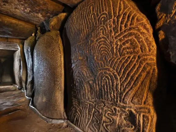
Constructed as a monumental two-chambered dolmen with an elongated ‘dromos’ originally concealed beneath an earthen tumulus, Golyam Dervent is unique in Bulgaria for its richly sculpted stone façade. Carved in relief directly into the megalithic slabs are spirals, geometric meanders, and a prominent double axe (‘labrys’), an unmistakable emblem of royal and aristocratic authority in ancient Thrace (Nekhrizov, 2015).
Oriented toward the southern solar sector (Kolev et al., 2008), Golyam Dervent also breaks from the communal family-tomb tradition seen elsewhere in Strandzha. Archaeological investigation indicates that it housed the burial of a single high-status individual, a local dynastic chieftain asserting his lineage and territorial claim directly in carved stone.
Excavation finds date the Golyam Dervent dolmen firmly to the 9th and 8th centuries BCE (with its primary phase placed in the 8th century BCE) (Dichev, 2006).
Taken together, Nachovi Chairi, Roussa, Belevren, and Golyam Dervent shatter any lingering notion of a quiet, impoverished Balkan "Dark Age." From the sheltered ravines of Sakar to the exposed Aegean frontier of Evros and the royal relief-carved portals of Strandzha, these were not the frantic monuments of dispossessed refugees. They were astronomically aligned, richly furnished stone fortresses for an iron-armed warrior aristocracy. Physical anchors bolted into the bedrock to hold ancestral territory against a volatile post-collapse world.